-
Muskoka Heritage Nuggets, Volume II,
Just released this month, Nuggets II contains 14 features by Muskoka historian J. Patrick Boyer on wide-ranging topics with something of interest to everyone: Gordon Lightfoot, Early Councils, Bush Farming, Horse Power, British Offsets, Getting Mail, Dominion Day, Wildlife’s Shield, Muskoka Cure, Bird’s Wool, Winter Logging, Chautauqua Power, Dark Homecoming, and Dorothy’s Enigma.
-
Muskoka Heritage Nuggets, Volume I
Nuggets gathers magazine features written over several decades by Muskoka historian J. Patrick Boyer. His wide-ranging subjects were assigned by savvy Muskoka publishers attuned to topics of popular appeal. Richly illustrated with 149 photographs and 15 illustrations, the 14 “nuggets” include Chief Musquakie, Muskoka Bridges, Muskoka’s Hospitals, First Bank, Photographing Muskoka, Muskoka Electricity, Gold Diggers, Treating Tumours, Bigwin Inn, and Windermere House. -
Putting Muskoka on the Map
From Indigenous Wayfinding to Satellite Imaging
Between Samuel Champlain’s first map in 1615 and today’s satellite images of Muskoka from outer space lies a centuries-long drama which proves that putting Muskoka on a map was neither easy nor simple.
-
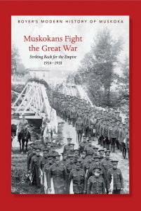
Muskokans Fight the Great War
Striking Back for the Empire, 1914-1918
In August 1914 Muskokans rushed to enlist in the British Empire’s war that was supposed to be over by Christmas. After four years, with millions of soldiers and millions more civilians killed, the euphoria had long since turned to grim despair.Muskokans Fight the Great War is historian J. Patrick Boyer’s lead-off book in a new series of modern histories about Muskoka. Launched last fall, this book includes previously undisclosed events and many never-before-published photos.


![Nokomis: A Novel [a Muskoka murder mystery]](/media/widgetkit/Nokomis_Specht--Muskoka_fiction-10d533389cbdc3953e98e5fb729448fe.jpg)


